
Bow and Arrow Subsurface Drip Irrigation Project
Service provided: Dispersal of natural gas produced water
Customer:  J.M Huber
Location: Campbell County, Wyoming
Daily capacity: 9,000 barrels (1.43 ML) per day
Project start date: August 2006
Area developed: 118 acres (49 ha) , 250 miles (402 km) drip tubing, 5 miles (8 km) pipeline, pond capacity 21 acre-feet (26 ML)
Water quality: EC = 2100 µS/cm, SAR = 32, Na = 550 mg/L, HCO3 = 1500 mg/L, TDS = 1350 mg/L
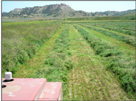
Crops produced: alfalfa (lucerne) – orchardgrass mix
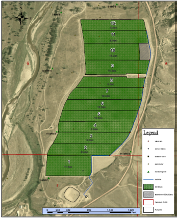
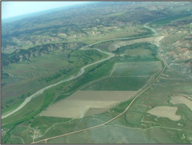
Situated on bottomland of the Powder River, five miles south of the Montana border, this property was a dryland hay meadow. Because it was concerned about potential impacts to the river, the Wyoming Department of Environmental Quality (WYDEQ) permitted the project with the qualification that it be located at least 1,000 feet (300 m) from the water.
BeneTerra initiated an intensive groundwater monitoring program by installing extra monitoring sites beyond those required by WDEQ. Static groundwater levels ranged from 6 to 21 feet (1.8 to 6.4 meters) below ground surface, and when the river rises with spring runoff, it has a substantial effect on groundwater elevation. To date, there is no evidence of impact to the river or groundwater quality. BeneTerra successfully reclaimed this site and left the land more productive than it was found, as evidenced by the initial baseline monitoring.